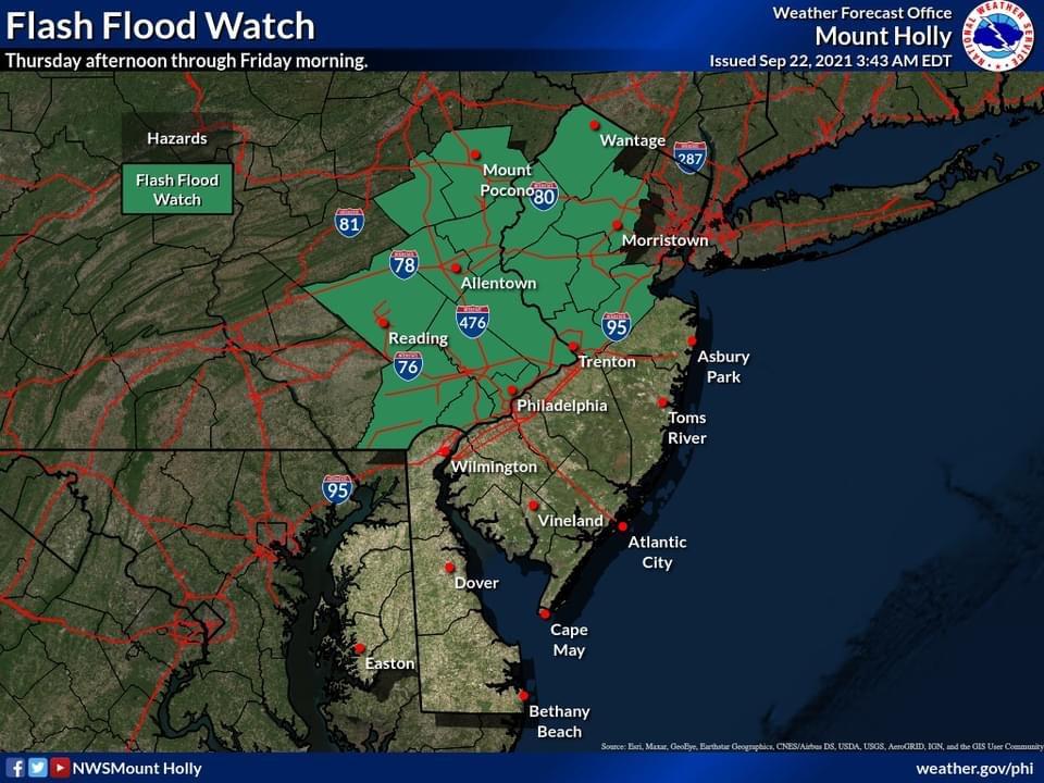
| A Flash Flood Watch has been issued by the US National Weather Service Philadelphia/Mount Holly for Montgomery County. It goes into effect tomorrow (Thursday) at 2:00 pm.
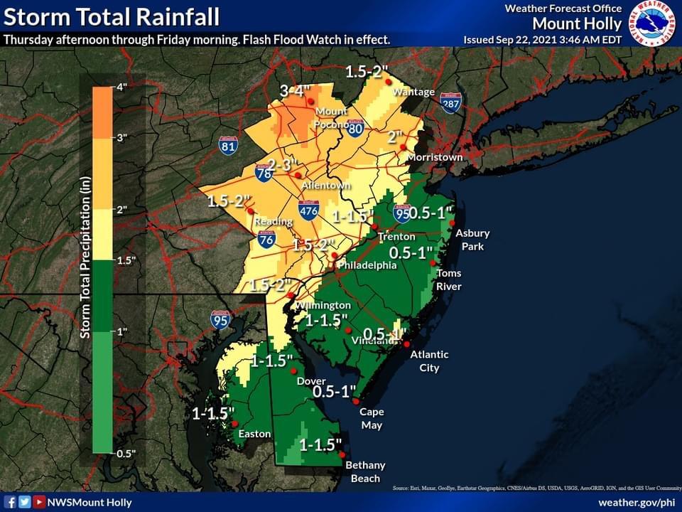
Showers and thunderstorms will develop ahead of and with the passage of a cold front Thursday afternoon through late Thursday night. Rain will be heavy at times, leading to the threat of flash flooding. Widespread rainfall totals will range from 2 to 3 inches with locally higher amounts.
Damaging straight-line winds and isolated tornadoes are also possible, with the main threat occurring from Thursday afternoon into the early overnight hours Thursday night.
Remember: Turn around…don’t drown.
A Flash Flood Watch is now in effect for portions of eastern PA and northern NJ from Thursday afternoon through Friday morning. Showers and thunderstorms producing heavy rain will affect the region during that time as a slow moving cold front moves across the region.
The latest briefing package for this event is now available.
https://www.weather.gov/media/phi/current_briefing.pdf |